Filtrer les résultats
Résultats de la recherche
| Médias | Titre | Cote | Date | Lieu | Type de document | |
|---|---|---|---|---|---|---|
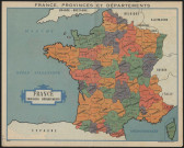
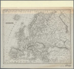
| Résultat n°1 |
|
Cote 5758W
|
Date XIXe-XXe siècles
|
Lieu - |
Type de document
CARTE, PLAN
|
|
|
||||||
|
Résultat n°2
|
2 lots 7 medias |
Cote 30Fi80
|
Date 1954
|
Lieu
RHONE (FRANCE ; DEPARTEMENT)
|
Type de document
CARTE
|
|
|
||||||
|
Résultat n°3
|
2 lots 3 medias |
Cote 30Fi79
|
Date 1934
|
Lieu
RHONE (FRANCE ; DEPARTEMENT), LA ROCHELLE (CHARENTE-MARITIME, FRANCE)
|
Type de document
CARTE
|
|
|
||||||
|
Résultat n°4
|
2 lots 5 medias |
Cote 30Fi78
|
Date 1932
|
Lieu
RHONE (FRANCE ; DEPARTEMENT)
|
Type de document
CARTE
|
|
|
||||||
|
Résultat n°5
|
2 lots 6 medias |
Cote 30Fi77
|
Date 1925
|
Lieu
RHONE (FRANCE ; DEPARTEMENT)
|
Type de document
CARTE
|
|
|
||||||
|
Résultat n°6
|
2 lots 3 medias |
Cote 30Fi76
|
Date 1921
|
Lieu
RHONE (FRANCE ; DEPARTEMENT), BERGERAC (DORDOGNE, FRANCE)
|
Type de document
CARTE
|
|
|
||||||
|
Résultat n°7
|
2 lots 9 medias |
Cote 30Fi75
|
Date 1913
|
Lieu
RHONE (FRANCE ; DEPARTEMENT)
|
Type de document
CARTE
|
|
|
||||||
|
Résultat n°8
|
2 lots 3 medias |
Cote 30Fi69
|
Date 1888
|
Lieu
RHONE (FRANCE ; DEPARTEMENT)
|
Type de document
CARTE
|
|
|
||||||
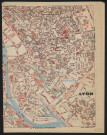
|
Résultat n°9
|
1 media |
Cote 2Fi17
|
Date s.d.
|
Lieu
LYON (RHONE, FRANCE)
|
Type de document
CARTE, CARTE GEOGRAPHIQUE
|
|
|
||||||
|
Résultat n°10
|
1 media |
Cote 2Fi16
|
Date s.d.
|
Lieu
LYON (RHONE, FRANCE)
|
Type de document
CARTE, CARTE GEOGRAPHIQUE
|
|
|
||||||
|
Résultat n°11
|
1 media |
Cote 2Fi15
|
Date s.d.
|
Lieu
LYON (RHONE, FRANCE)
|
Type de document
CARTE, CARTE GEOGRAPHIQUE
|
|
|
||||||
|
Résultat n°12
|
1 media |
Cote 2Fi14
|
Date s.d.
|
Lieu
RHONE (FRANCE ; DEPARTEMENT)
|
Type de document
CARTE, CARTE GEOGRAPHIQUE
|
|
|
||||||
|
Résultat n°13
|
1 media |
Cote 2Fi13
|
Date s.d.
|
Lieu
RHONE (FRANCE ; DEPARTEMENT)
|
Type de document
CARTE, CARTE GEOGRAPHIQUE
|
|
|
||||||
|
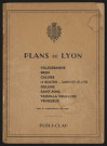
Résultat n°14
|
2 lots 14 medias |
Cote 2Fi12
|
Date 1954
|
Lieu
LYON
|
Type de document
PLAN
|
|
|
||||||
|
Résultat n°15
|
2 lots 6 medias |
Cote 2Fi11
|
Date 1961-1962
|
Lieu
LYON, VILLEURBANNE, FRANCE, EUROPE, RHONE (DEPARTEMENT)
|
Type de document
PLAN
|
|
|
||||||
|
Résultat n°16
|
2 lots 40 medias |
Cote 2Fi10
|
Date 2e moitié du XXe Siècle
|
Lieu
LYON, TASSIN-LA-DEMI-LUNE, OULLINS, VILLEURBANNE, VENISSIEUX, BRON, SAINT-FONS, SAINTE-FOY-LES-LYON, CALUIRE-ET-CUIRE, LA MULATIERE
|
Type de document
PLAN
|
|
|
||||||
|
Résultat n°17
|
2 lots 10 medias |
Cote 2Fi9
|
Date 1980
|
Lieu
RHONE (DEPARTEMENT), LYON, TASSIN-LA-DEMI-LUNE, OULLINS, VILLEURBANNE, VENISSIEUX, BRON, SAINT-PRIEST, VILLEFRANCHE-SUR-SAONE
|
Type de document
PLAN
|
|
|
||||||
|
Résultat n°18
|
2 lots 4 medias |
Cote 2Fi8
|
Date 1ère moitié du XXe Siècle
|
Lieu
LYON
|
Type de document
PLAN
|
|
|
||||||
|
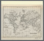
Résultat n°19
|
2 lots 2 medias |
Cote 2Fi7, 3Pl492
|
Date XIXe siècle
|
Lieu
EUROPE
|
Type de document
CARTE, CARTE GEOGRAPHIQUE
|
|
|
||||||
|
Résultat n°20
|
2 lots 2 medias |
Cote 2Fi6, 3Pl491
|
Date XIXe siècle
|
Lieu - |
Type de document
CARTE, CARTE GEOGRAPHIQUE
|
|
|
||||||